• New Horizons on Maelstrom
    Maelstrom New Horizons


    Visit our website www.piratehorizons.com to quickly find download links for the newest versions of our New Horizons mods Beyond New Horizons and Maelstrom New Horizons!

Weather, and geographic data assimilation

Strannik

Sailor Apprentice
Programmer
Provisional
Hearts of Oak Donator
Hi guys,

I don't know how realistic you intend to make your weather system, but I have quite a bit of experience in reading and assimilating scientific data, as well as experience in C programming.

I was part of the Magna Mundi mod for EUIII and the Magna Mundi game, before it got cancelled, and my role was the assimilation of geographic data, map making, and cartography.

I could help develop realistic wind patterns and weather simulation for hearts of oak based on current data and what other team members may know about the past. This could include realistic seasonal variations and hurricane seasons.
 
Most of my work would involve assembling the data and re-casting it in formats that the engine can work with. I'm very good at scientific programming, but will very likely need help incorporating this into the game.

A very rough plan of what I can do do is this:

1. Find wind pattern and oceanic current data, and its variability with time. I work closely with people at NASA who has access to this kind of data. You can see it here:
2. Use it to define a "typical" yearly variation , as well a statistic deviations.
3. Define a large-scale wind pattern and a system of oceanic currents, for the geographical area of the game, that smoothly morphs as the year progresses. This would involve monthly or weakly averages and would be mapped to a coarse grid. Hurricanes would not be included in this characterization.
4. Characterize the statistical deviations from this mean-large scale pattern at a local level so that the local wind varies for the player. Hurricanes would not be included in this characterization.

Much more can be added at a later time, but I would suggest we start with the wind patterns. Then next step could be hurricanes, I once saw a presentation by an MIT scientist who studies them, I know I can look up his work and come up with realistic, but simple statistics regarding their frequency, geographical shape, wind speeds, strength, and paths. Then during hurricane season we can use them to super impose a hurricane on the general wind pattern. Another, later stage could be precipitation and tropical storms (or perhaps they should be implemented before hurricanes).

Something along this lines.
 
Something else I would be interesting in doing is an interactive map of the Caribbean showing different information. Ownership, piracy levels, trade routes, wind patterns and oceanic currents, trade prices, etc. Of course people back then didn't have any of this information readily, but in my opinion it would greatly enhance the game for most people (except perhaps the most hardcore). Just brainstorming ideas.
 
Both those ideas would be very welcome indeed!

@Captain Murphy and myself had some ideas on the weather system as well and it sounds like your ideas would fit right in with that.
@Lodewijk was working on it before, but now he doesn't have time to continue until December or so.

Do you know if there are any "climatological" databases available somewhere?
We do have the nautical Pilot Charts, but those would need some heavy adaptation to be able to work as input for the game.
 
After I quick search I found this:

http://www.ncdc.noaa.gov/data-access/quick-links

Some links don't work, but I'm sure that I can find exactly what I need if I put a little effort. I can also ask someone to put me in touch with the people that work in this field. How should we proceed? Shall I give it a try and post my progress here?
 
Ok guys. I found the wind data. It is extremely detailed and of a very high cadence! There are four measurements per day from 1987 to 2011 for the entire world at a resolution of 0.25 degrees. We can do perfection if we want :)

The data can be downloaded here: http://podaac.jpl.nasa.gov/dataset/CCMP_MEASURES_ATLAS_L4_OW_L3_0_WIND_VECTORS_FLK

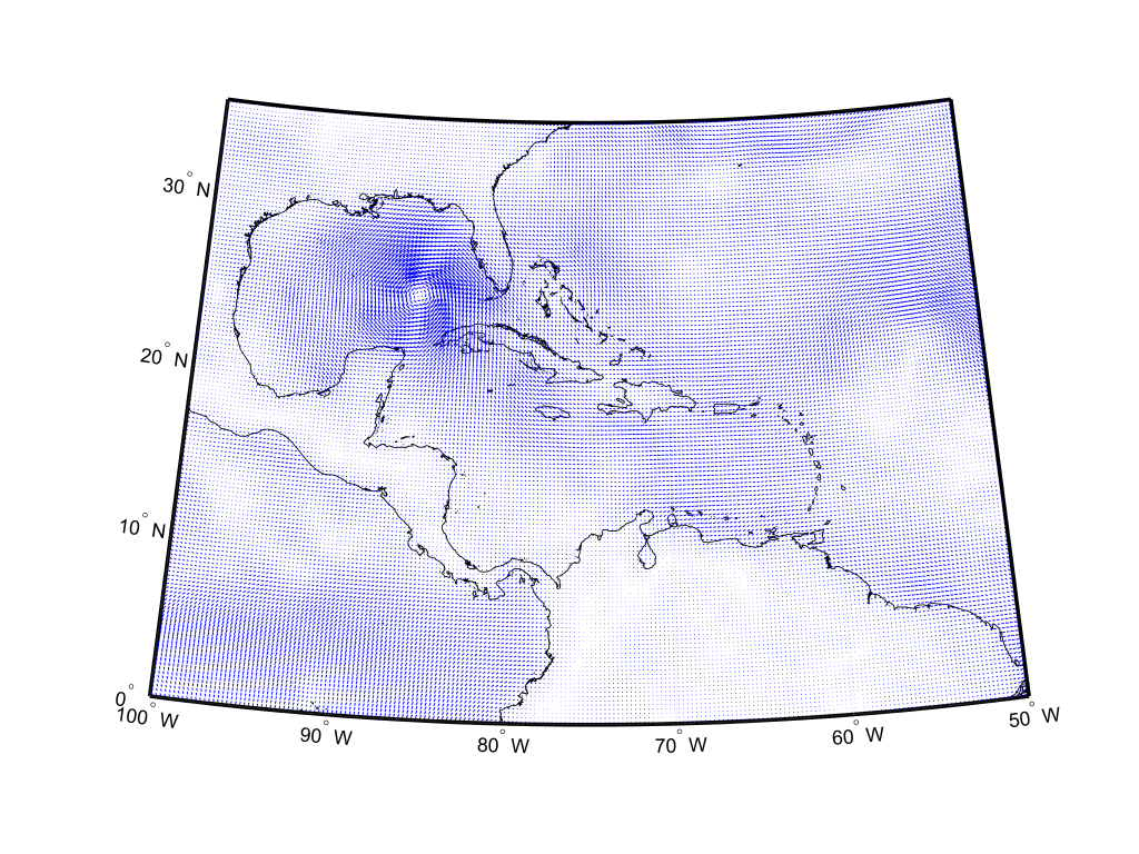
Here is Katrina as an example

Katrina.png

(be sure to download the full size image ;)): https://dl.dropboxusercontent.com/u/408446/Katrina.png
 
Last edited:
Wow, impressive! Looks like actual database files too, which should be easier to work with.
Of course they are historical data, not climatological. But surely with that many years, we can just add all databases together and average them out.
 
@Pieter Boelen
I'm not sure if that works. We are aiming at pre industrial revolution times. So we would need to exclude the impact of mankind on the climate somehow.
The last little ice age was around 1850. Since then the climate got warmer and warmer, due to burning of fossil fuels, mostly coal...
 
How much different would the climatological wind direction and speed have been several hundred years ago?
And is there any way of even finding out? Would anyone notice the difference?
Especially once we throw our randomization layer on top?
 
I'm not sure if that works. We are aiming at pre industrial revolution times. So we would need to exclude the impact of mankind on the climate somehow.
The last little ice age was around 1850. Since then the climate got warmer and warmer, due to burning of fossil fuels, mostly coal...
Nobody said we need to make the climate 100% accurate. Having a realistic wind model is an achievement in itself.
 
Back
Top