Well, when I sighted Tortuga the winds died and I had to zig zag a lot. But unless I misread the dates that is how long it took.
-
Visit our website www.piratehorizons.com to quickly find download links for the newest versions of our New Horizons mods Beyond New Horizons and Maelstrom New Horizons!-
Quick links for Beyond New Horizons
- Download latest version
- Wiki - FAQ - Report bugs here - Bug Tracker on Github -

Quick links for Maelstrom
- Download the latest version of Maelstrom
- Download the latest version of ERAS II - Download the latest version of New Horizons on Maelstrom
-

Quick links for PotC: New Horizons
- Download latest version
- Wiki - FAQ - Report bugs here
-

Thanks to YOUR votes, GOG.com now sells:
- Sea Dogs - Sea Dogs: Caribbean Tales
- Sea Dogs: City of Abandoned Ships
Vote now to add Pirates of the Caribbean to the list! -

Quick links for AoP2: Gentlemen of Fortune 2
- Downloads and info
- ModDB Profile
- Forums Archive -

A Pirate Podcast with Interviews
Music, Comedy and all things Pirate!
- Episode Guide - About - Subscribe -
- Twitter - Facebook - iTunes - Android -
- Youtube - Fill the Coffers -
You are using an out of date browser. It may not display this or other websites correctly.
You should upgrade or use an alternative browser.Ship Encounters and other stuff on world map
- Thread starter Bathtub-pirate
- Start date
The 2nd test run is done. And – man – it was worth it.
Note of course, that my examples are massively simplified. I always just assume the straightest course as ideal, where landmass is bypassed in an efficient manner without taking considerable and unnecessary detours. That however, was hardly how it went down in reality, since other than the strength and direction of the wind, the tides, currents and topographic nature of the coastal areas would greatly influence which course a ship would (or even could) take. Also the dimensions and draft of a ship as well as the navigational skill of the officers/the captain, the skill of the pilot and the skill of the overall crew were contributing factors.
But since the game does not include the behavior of currents and the risk of reefs and shallow coastal waters, these factors are out of the occasion. Gotta judge the game on it's own merits.^^
The next test run was a distance trip from Charlestown, Nevis to Port Royal, Jamaica. So a longer trip than my first one, but pretty cut and dry as far as the course went: straight to the west (safe for some little stretches of land on the start and the arrival). The real distance between the two ports would have to be something like 1520 km. If I would want to cover that distance in four days, I would have to reach an average speed of just slightly above 8,5 knots.
With the wind blowing at 24 knots from S at 22:49 on the 15th of May, the conditions looked just fine.
And quite early during the journey I couldn't help but to feel that this was going too fast. I touched the waters of Puerto Rico and Isla de Mona long before the first day of the journey was even through, which constituted like a third of the way already. And at this point, looking at my numbers so far, I definitely didn't even have the average of just over 8,5 knots.
Lo and behold! I reached Port Royal, Jamaica at 12:27 (and therefore included the last speed reading, for it was nearly 30 minutes after the full hour) on the 17th of May. That constitutes a travel time of not much more than one and a half day (39 readings representing roughly 39 hours) with an average speed of 8,79487 knots….. The speed, that would realistically allow me to reach the port just somewhat south of four days. And I did it somewhat north of one and a half. Something is really wrong here ...
In order to manage a distance like the one between Charlestown and Port Royal in the time I did, an average traveling speed of over 21 knots would 've been required. Can you say Super Clipper! Only the fastest of traditional 19th century sailing ships might even have a very slight chance of being that fast … ideal circumstances – all the way – absolutely necessary! This and the captain risking that the sails may fly around the ears of him and his crew probably sooner than later.^^
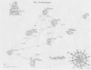
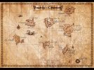
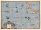
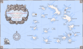
I think the problem is far more mundane than my initial assumption about localization being troublesome. It is that the dimensions of the Caribbean in the game are simply inaccurate, as far as the east to west distances go. And that becomes really obvious if we look at the map of the game, that is of nearly quadratic proportion. Whereas the real map of this major chunk of the Caribbean would be much more like a rectangle, stretching from left to right. So the Caribbean, as it is right now in the game, is clinched considerably from east to west.
Notice that my first trip was pretty much a north to south trip and it was right on the money. But now from Charlestown to Port Royal (east to west) it was nowhere near in-sync with the real time data.
Also I noticed that the constellation of some of the islands to each other is not correct. The distance from Bonaire to it's western neighbor, Curacao, in reality is below 60 km. Whereas the real distance to Grenada, it's eastern neighbor, is around 700 km. In sharp contrast to that, Grenada in the game is just barely further away from Bonaire than Curacao is. Note that we are talking about an east to west distance here again. Also Barbados should be the sole most eastern located island in the game as it in reality is considerably further in the east than Antigua (also Martinique is entirely further in the east than Antigua BTW).
To demonstrate how the Caribbean in the game is clinched east to west, it makes sense to compare how far the most northern, southern, western and eastern points of interest are away from each other in reality. The distance between the island of Eleuthera to Cartagena is 1645 km. The distance from Cozumel to Antigua is 2668 km (center to center). That is slightly more than 1000 km more than the North-South distance from Eleuthera to Cartagena. And now consider that Barbados (in the game pretty much the same longitude as Antigua) is actually roundabout 230 km further to the east than Antigua, therefore increasing the error in actual east to west … errrgh ... shortage.
Also - remember the original distance from Charlestown, Nevis to Port Royal, Jamaica being roundabout 1520 km? That is just 125 km short of the real distance between Eleuthera and Cartagena. Now compare that to the dimensions within the game, where you would pick a trip from Nevis to Jamaica over a trip from Eleuthara to Cartagena without hesitation, for it would be that much (*cough*) shorter.
Well, not really ...
That obviously has to create major weirdness in travel times. The game doesn't necessarily do anything wrong. It's just the dimensions, it is based upon, are off.Last edited:Good job!
Thanks! I 've rewarded meself with a glass of Rum/Cola for it.
I never really noticed the east-west compression because most of my runs are north-south runs.
As a greedy merchant I advise you to intensify your east/west business, as long as the advantage exists.^^ As did I, when I took a cargo job with my Bermuda Sloop speedboat, bringing gold from Jamaica to Sao Jorge for 39k ... but being also a ruthless merchant, I probably should sell this gold myself, where it is in hot demand. I play as Cutler Beckett, so it would entirely be in character. If you really want to be greedy get thyself a real ship and fill it with ebony at Santiago and then smuggle it into Jamaica. Over $1,000,000 easy.
 @Armada did the current world map. I think he did the best he could.
But if I recall, the game engine basically doesn't allow a much larger map.
I feared that something lik this might be the case. Well, at least I could solve the mystery why the trips felt so inconsistent and often short.Honestly, this game engine itself is a mystery sometimes.
The map is 'squashed' for two reasons:
1) It's a fixed scale, and has to be a square
2) We imported the mainland section from the AoP2 world map, which itself is a highly distorted rendition of the real terrain
The main goal of the current map was to incorporate the mainland and position the other islands in roughly the right places.
That meant having to position the islands relative to the mainland, which effectively caused the distortion.
We could have squashed the mainland itself to be a better fit, but that would mean that any locations we use for it wouldn't match up properly.
Below is how the map looks from a top-down orthographic view; the blue square is the fixed playable area we have to work with:
The only real solution would be to correct the positions of all the islands in both 3D sailing mode and the world map, and to adjust the mainland model to fit better.
It's... doable, but the world map is one giant 3D model, and so moving the islands around requires more than editing coordinates in the code.
Anybody with knowledge of Maya could physically adjust the world map model, and I could offer guidance on the export process, but the rest is stuff I don't have time for any more.Current situation might not be perfect but it is beget than any previous version we've had.
I'd be fine with keeping it as is.Well, turns out that the very unreliable maps from back in the day are actually accurate in POTC.^^ Given that Akella never had any intentions of making a realistic Caribbean in the game (with the abstracted names and completely made up locations of the islands), it is what it is, I guess.
And make no mistake about it guys: I am not ranting here. Certainly the way it is now is leaps and bounds ahead of anything previous.
So the shape of the map is fixed as being square. But what about the dimensions? Can these be altered? A bigger square would surely be able to contain a more accurate Caribbean. And even more historical islands. Like the Bahamas (mostly Nassau, New Providence) or Dominica etc. Also installing several cities on the mainland would become probably even more viable.It's a fixed scale, and has to be a square
What about the discrepancy in travel times (between DirectSail and world map)? Was that better or worse in previous maps, do you think?The current map is actually pretty good compared to what came before. I am not complaining.
I can't remember the specifics, but all I know is I had to fit the map into a square of a fixed size. I think the size was either 1024 or 2048 metres.So the shape of the map is fixed as being square. But what about the dimensions? Can these be altered?
The actual geometry can extend beyond that square (as in the image I posted), but it lies outside the playable area.
Maybe it is possible to alter the size, but it would mean digging through the code to find out whether it's a variable we can access or whether it's hard-coded.World map travel is pretty fast as I always arrive with lots of time to spare.
Direct sail is completely random and depends on the ship, skill, and luck. Usually I arrive with plenty of time left and actually timing out is very rare, but there have been many times when it got pretty close.I have missed my time by months once , accidentally sailed though the panama canal many years before it existed


