• New Horizons on Maelstrom
    Maelstrom New Horizons


    Visit our website www.piratehorizons.com to quickly find download links for the newest versions of our New Horizons mods Beyond New Horizons and Maelstrom New Horizons!

Solved Updating the Worldmap

yes but the mainland map is the one showing where to do the convoy/cargo mission, where treasure are and your current location (of your ship)
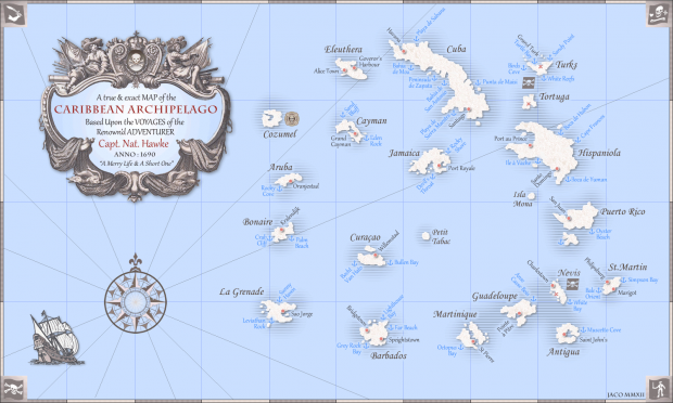
Ah, yes. Thankfully THAT map auto-updates from the Worldmap. It is the F2>Inventory>Maps>Caribbean Map that doesn't.

i use it a great lot and its REALLY useful for convoy/cargo mission <= always using it for that and also to check my location on sea
I guess it you like the recent additions with the shown items and legend then? Glad to see it is appreciated! :cheers
 
Out of curiosity, what are those bright blue outlines around the islands on that top view?
Those represent the foam where the sea meets the land, just like the old map had. See the white island-shaped blobs in the three in-game screenshots? Same thing.
As I said before, rendering the map from Maya with an alpha channel worked perfectly for generating those outlines exactly where they were needed. :cheeky
 
I guess it you like the recent additions with the shown items and legend then? Glad to see it is appreciated! :cheers

yes thats purely awesome :D

i also like to print the map and put every islands map details on it, so i always have the map with complete info while playing (without going to any menu :p )

that makes me having a great view of the entire archipelago ;)
 
Those represent the foam where the sea meets the land, just like the old map had. See the white island-shaped blobs in the three in-game screenshots? Same thing.
Thanks. I imagine you'll be tweaking the textures for "prettiness" later on, right?

i also like to print the map and put every islands map details on it, so i always have the map with complete info while playing (without going to any menu :p )
that makes me having a great view of the entire archipelago ;)
You mean you make your own version of this?
potc-archipelago-map.png
 
Thanks. I imagine you'll be tweaking the textures for "prettiness" later on, right?

How do you mean? I've already cleaned up the sea texture to remove the old outlines and apply the new ones, as shown in this post: http://www.piratesahoy.net/threads/updating-the-worldmap.20710/page-6#post-454558
What you see there is the sea texture itself with the alpha mapped render of the islands superimposed over it, and all rotated 180 degrees so it's the right way up.
 
sounds perfect! I think we should place the locators/arrows like in Port Royale, if anybody knows that? I could do a quick drawing^^
 
ok, I took Armada's map and added a few important cities on the mainland (if we need them in the future ;) ) and (in my opinion) good locators/arrows for London, Amsterdam, Spain and Portugal (didnt know which ports we want for these) Singapore and Cape Town (because I think this was an important trading city). You'll maybe need to zoom in to see my dots^^WorldMap_new9.jpg
 
Those shore outlines looked a bit too "firm" to me on the screenshot. But perhaps it looks better when zoomed in the game. :shrug

True, but ironically the texture file compression actually helps to make these lines a bit more natural.
Take a look at the existing world map yourself in-game and note the outlines of the islands there. The new outlines look exactly the same. ;)
 
OK, I've finally moved all the coordinates around for the islands, towns and shores. So many numbers... :8q

So here is the first in-game screenshot of the new map with the correct sea texture and labels, featuring part of the mainland with Colombia:
WorldMap_new10.png
Things I still need to do before releasing:
1) Get the mainland Colombia location to work when exiting the World Map.
2) Move Isla de Muerte to a new location (which I will keep secret and challenge you to find :razz). I don't know where the code for this is, yet.
3) Make a small cursed coin model to represent Isla de Muerte.
4) Make arrow models to represent locations outside the Caribbean.
 
I've just finished points 2 and 3, so that just leaves 1 and 4, now. :dance

Want to know where Isla de Muerte now lies? I'll give you one hint:
IslaDeMuerte.jpg
 
just thought about this: Can we also import the seasides from Voyage Century? If not, we won't have the possibility/time to design the ports for the cities (the sea-side ports), do we? Would it than be possible to instantly go to the city without sailing to the port (And of course the other way round, too)?
We'll have to see what they've got. :yes

True, but ironically the texture file compression actually helps to make these lines a bit more natural.
Take a look at the existing world map yourself in-game and note the outlines of the islands there. The new outlines look exactly the same. ;)
Perfect! :onya

OK, I've finally moved all the coordinates around for the islands, towns and shores. So many numbers... :8q

So here is the first in-game screenshot of the new map with the correct sea texture and labels, featuring part of the mainland with Colombia:
Awesome, awesome and awesome! Did I mention this is awesome yet? :razz

1) Get the mainland Colombia location to work when exiting the World Map.
Doesn't that already work with the Beta 3 WIP files I uploaded? I thought it did. o_O
You found to code in PROGRAM\NK.c already, I suppose? Though of course that needs moving to the NORMAL island code files for Cartagena.
 
One question. I keep getting a message about Grenada island coordinates being off. Have you noticed anything like that while moving the coordinates around?

Awesome work! :bow Can we say awesome too much? xD
 
Doesn't that already work with the Beta 3 WIP files I uploaded? I thought it did. o_O
You found to code in PROGRAM\NK.c already, I suppose? Though of course that needs moving to the NORMAL island code files for Cartagena.

Not that I've noticed. I'm still using Beta 3 WIP 7 though; is it different in WIP 8?
All I did was copy the code from NK.c and reconfigure it as a standard island with Cartagena as a proper city, and then disabled the NK.c lines that were copied.

One question. I keep getting a message about Grenada island coordinates being off. Have you noticed anything like that while moving the coordinates around?

Nope. Do you have any log files detailing that problem?

Awesome work! :bow Can we say awesome too much? xD
One can never have too much awesome. :cheeky
 
Not that I've noticed. I'm still using Beta 3 WIP 7 though; is it different in WIP 8?
All I did was copy the code from NK.c and reconfigure it as a standard island with Cartagena as a proper city, and then disabled the NK.c lines that were copied.
Not sure when I added the new Cartagena island model; should be before the WIP 8.
Anyway, as soon as I swapped out the island models in the code, it worked fine. So I'm not sure what problems you're still having. o_O
 
Not sure when I added the new Cartagena island model; should be before the WIP 8.
Anyway, as soon as I swapped out the island models in the code, it worked fine. So I'm not sure what problems you're still having. o_O

It just takes me to open sea when I leave the World Map when close enough to Cartagena. :shrug
I've attached my Worldmap_init.c and NK.c in case you can spot any errors.
 

Attachments

  • worldmap_init.c
    82.2 KB · Views: 96
  • NK.c
    133.9 KB · Views: 108
Back
Top